
# 2016 - Project Frontier
The high altitude balloon project that started it all
- Mission:
- To launch a probe to near space and photograph the curvature of the earth
- Date:
- Aug 20, 2016
- Status:
- Mission Successful
- Highest Altitude:
- 29,674.7 meters (97,358 feet)
- Launch Site:
- Toppenish Washington
- Flight Duration:
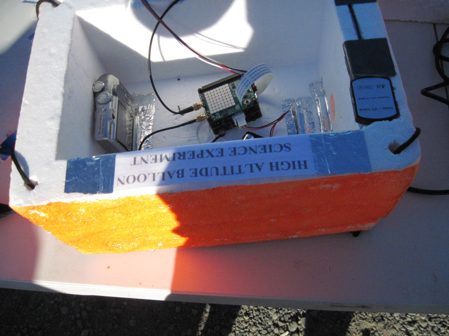
The payload package is made from styrofoam and contained two digital cameras, a Raspberry Pi with GPS and APRS tracking. The electronic components are powered by lithium batteries. It was painted orange for visibility.
The balloon has been filled with a tank of Helium and is just about ready to launch.

Airborn! The balloon has a surprising amount of upward thrust and quickly ascends above Toppenish Washington. It was at this point that we realized we had a major problem. An intermittent radio issue was now a full-scale problem as we were not receiving any tracking signal. The sky was brilliant though and easy to follow as it ascends.


Mount Adams on the left and Mount Rainier to the right coming into view.

A beautiful view of Mount Rainier. To the left you can see snow covered Goat Rocks which as an extinct stratovolcano in the Cascade Mountains.

Getting up there! Here's a view to the south across the Columbia River into Oregon.

Spectacular! This is our favorite photo. You can see Mount St Helens, Mount Adams, Goat Rocks, Mount Rainier, the Pacific Ocean and can just make out the Olympic Mountains!

After the helium gas expands so much and the balloon bursts it begins its descent very rapidly. It took about 2 hours to ascend and 30 minutes to descend. We were able to watch it all the way until it burst as a tiny sparkling dot. At this point we were in trouble since we had no tracking signal. As it continues to descend we drive to get as close to our projected landing spot as we can.


It was about this point that we realized the issue was a setting on the radio receiver. After it was corrected we got just a few pings so had a rough idea where it was about to land.


Looks like we will have to hike.


We had to come back the next day. By then the batteries were dead and we still had a pretty large search area.


Here's a video of the launch
Someone always asks about permits. As long as you meet a few criteria such as weight and proximity to airports, the requirements are pretty minimal. Although not required it is considered polite to notify others that a high altitude balloon is in the area. This is done with a NOTAM. Here is a screen shot of the one we filed.

Here is an interesting article that outlines how NOAA uses weather balloons to.. uh predict the weather. They launch many of these every day and do not file NOTAMs. NOAA use of weather balloons (opens new window)

Pressure altitude is an approximate altitude calculated from the pressure sensor in comparison to the average pressure at sea level.

The temperature inside the payload box made of styrofoam is significantly warmer than the freezing cold temperatures outside. After landing the temperature inside the box sitting out in the hot sun got very hot.


